 Richmond is a beautiful market town in North Yorkshire, set atop the ‘great hill’ that inspired the Normans to build a castle there. With its scenic woodland valleys, fast-flowing river, cobbled streets and period buildings, there is much to admire and explore in Richmond, as my husband and I discovered recently during a weekend break in the area.
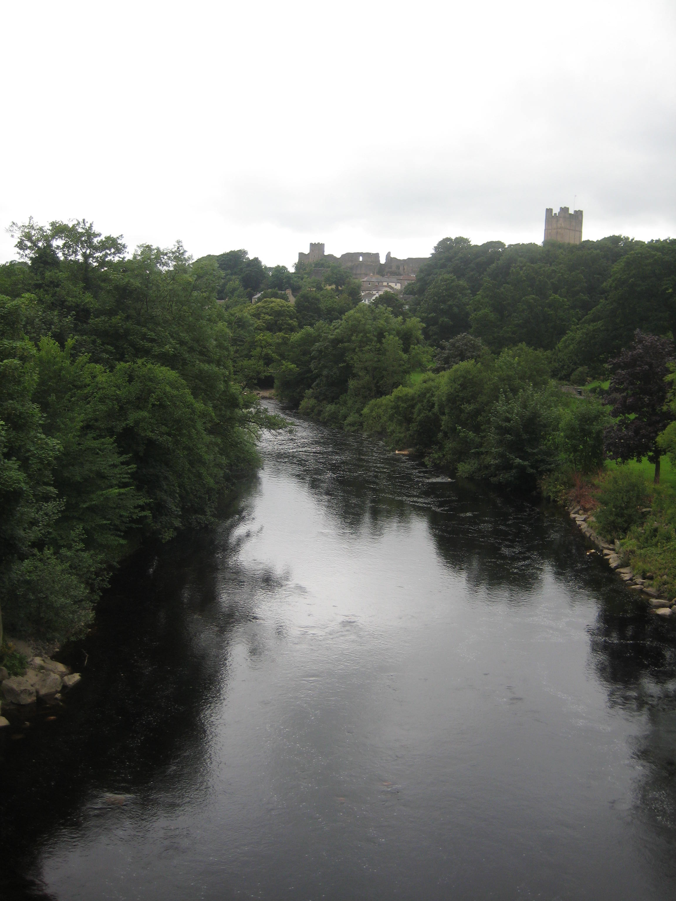
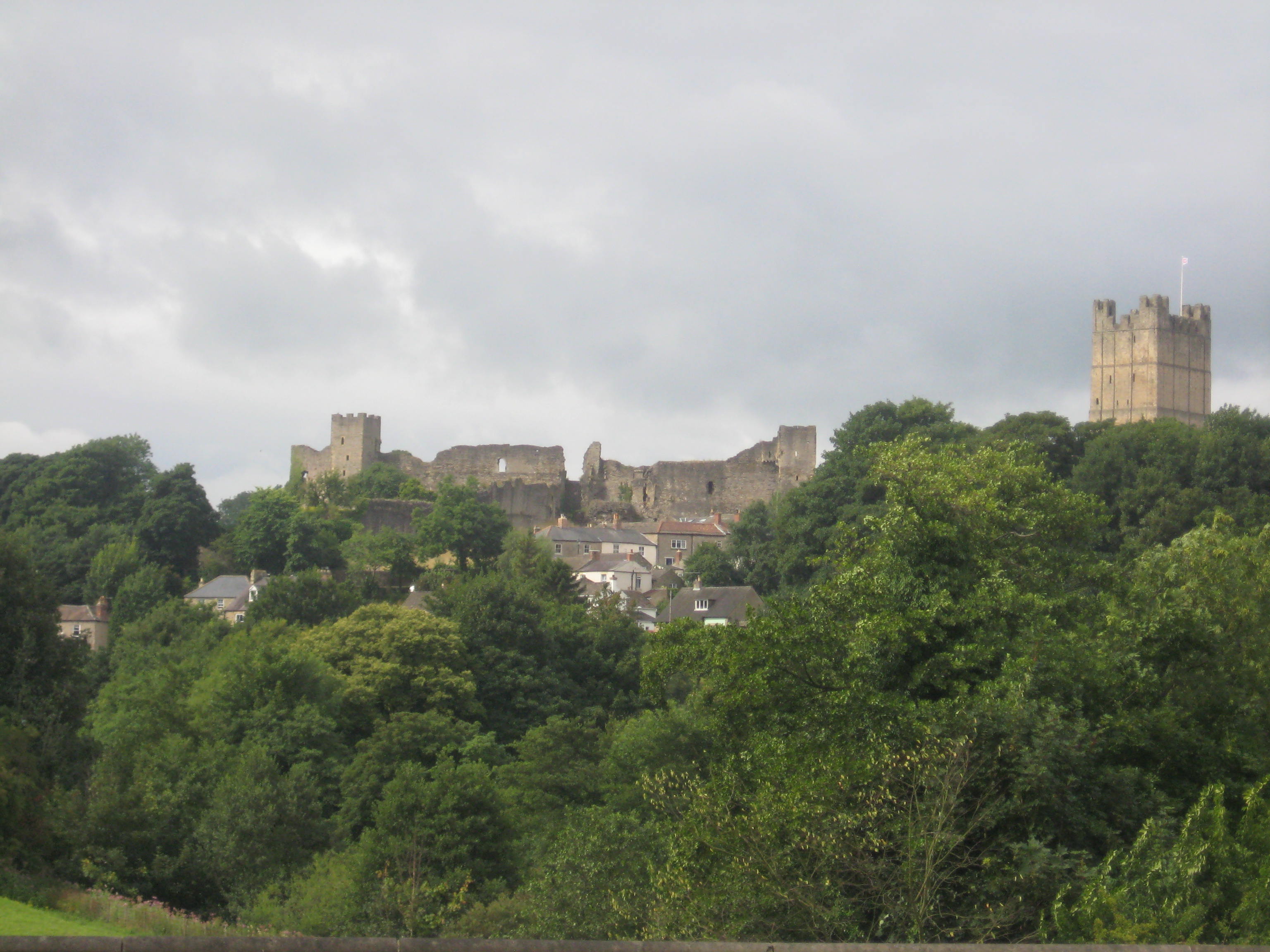
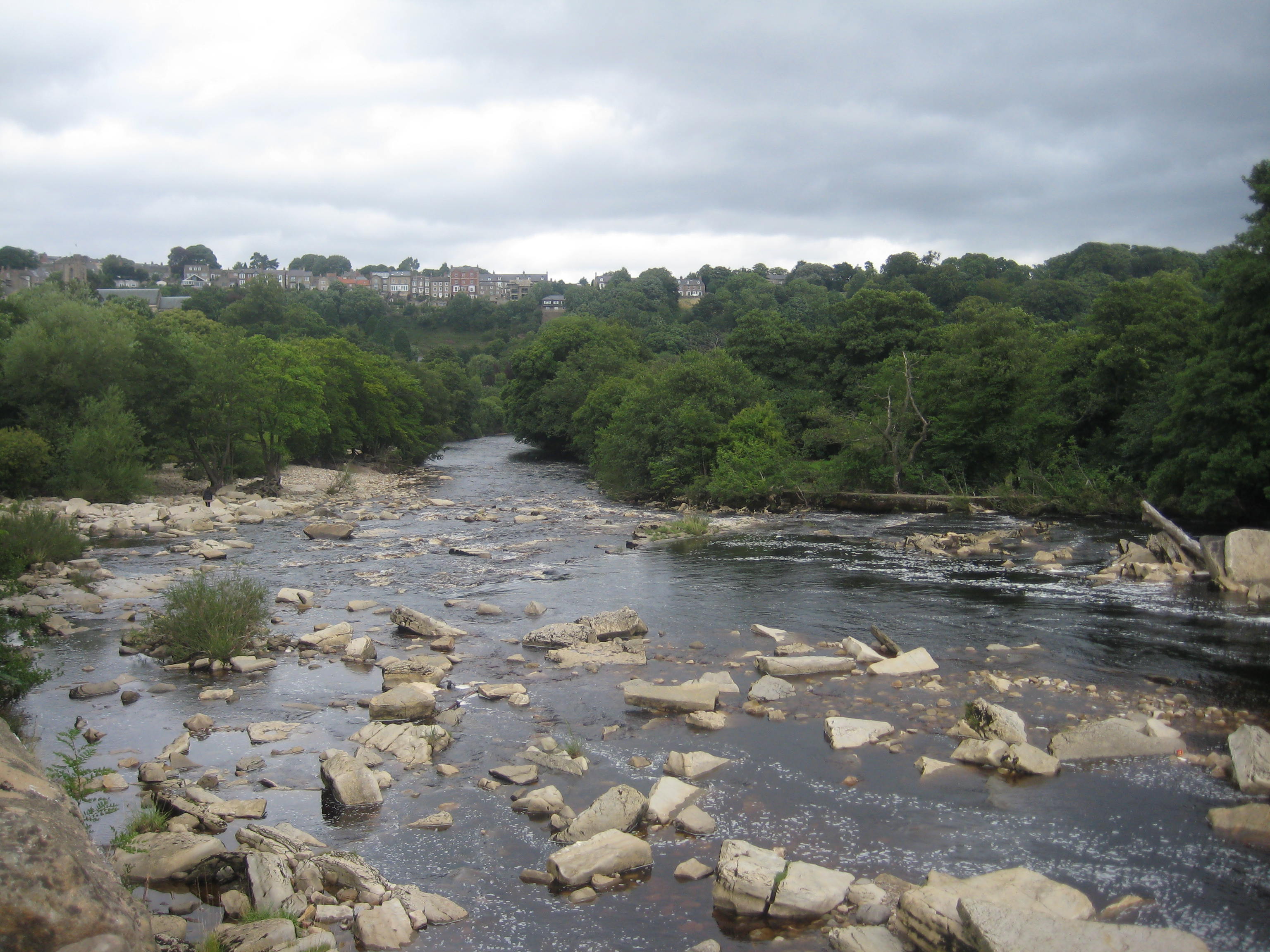
We started our tour on the bridge across the River Swale at the bottom of Station Road, a location which affords a stunning view of the town, with the castle dominating from its hilltop position.
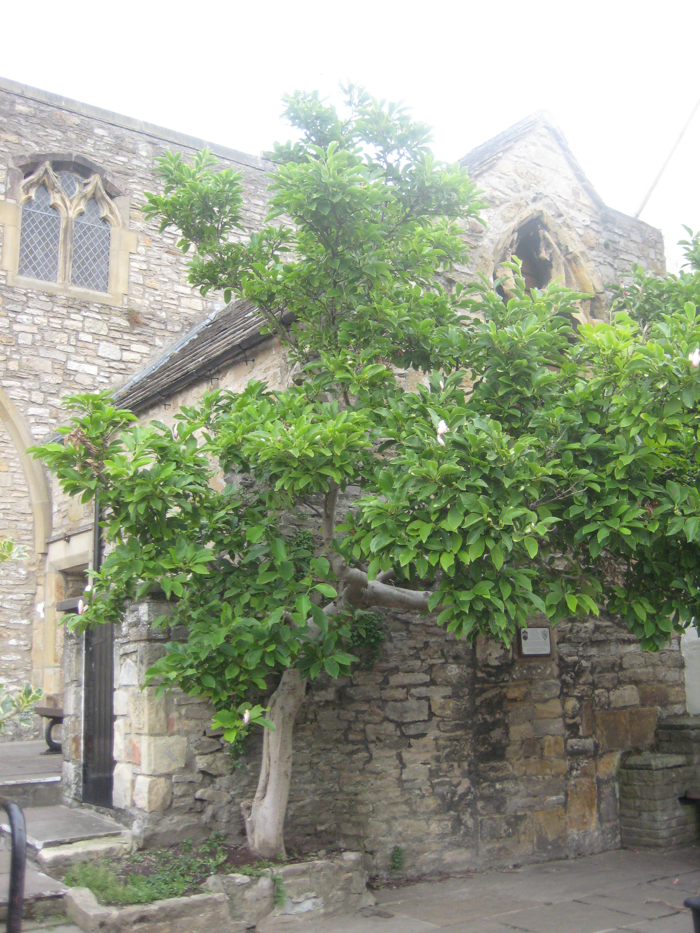
Climbing up the road, we turned left at the junction onto Frenchgate, which leads to the market place. The church that sits in the centre of this cobbled ‘square’ is Holy Trinity Chapel, believed to have been founded in 1154, when it would have abutted the castle’s outer bailey.

Over the centuries the church also served as a court, town hall, school and warehouse, and as a prison for the followers of Prince Charles Stuart after the Jacobite Rising of 1745. It is now used as a museum for the Green Howards, a Yorkshire Regiment named after the colour of its uniform and the surname of its original colonel.

Also of interest at Holy Trinity is a plaque commemorating the resting place in the south aisle of a Catholic martyr named John Acrige, who rebelled against Elizabeth I in the Northern Rising of 1569. He fled abroad before returning to Richmond, his birthplace. He died in a Hull prison in 1585.
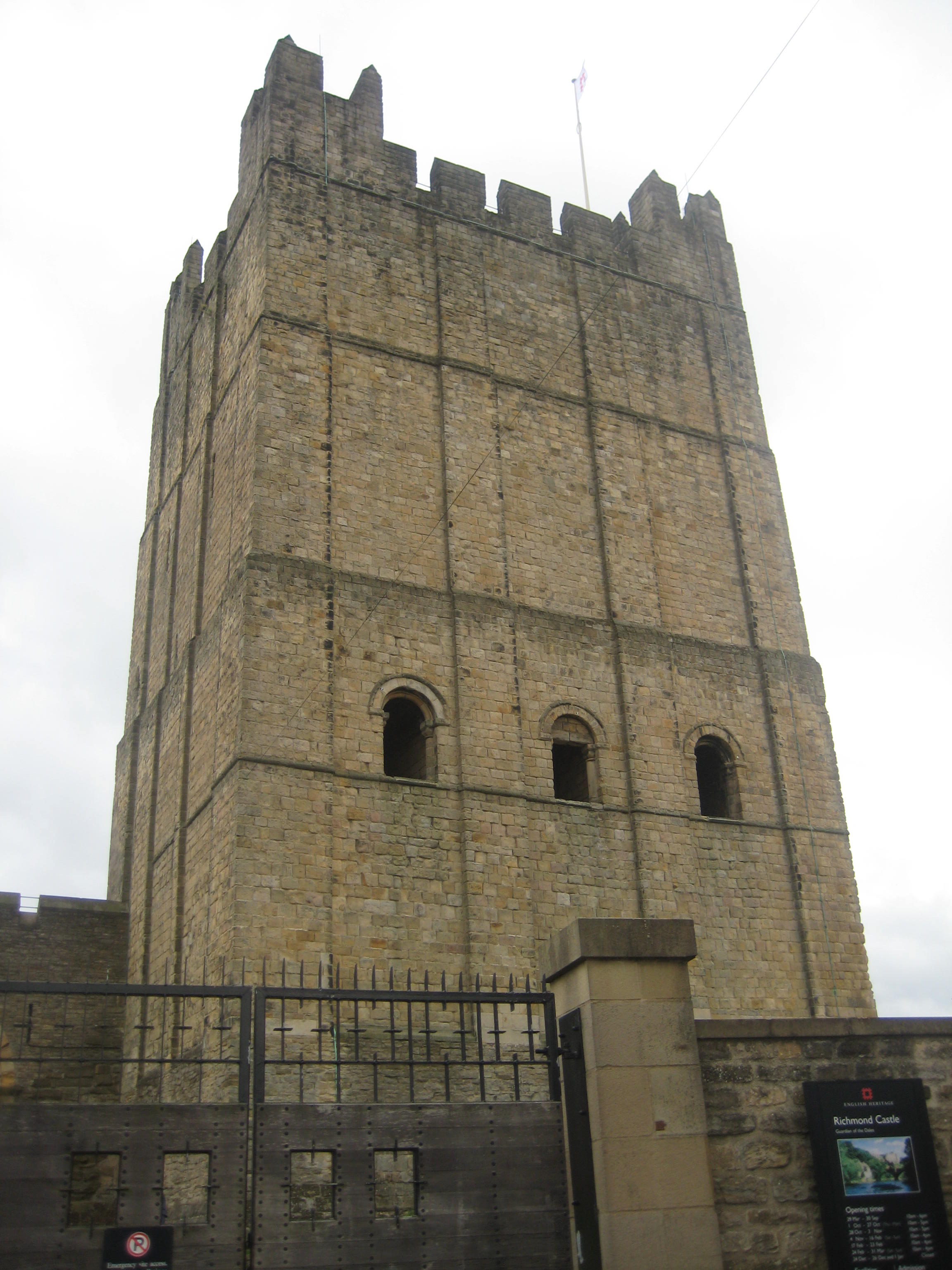
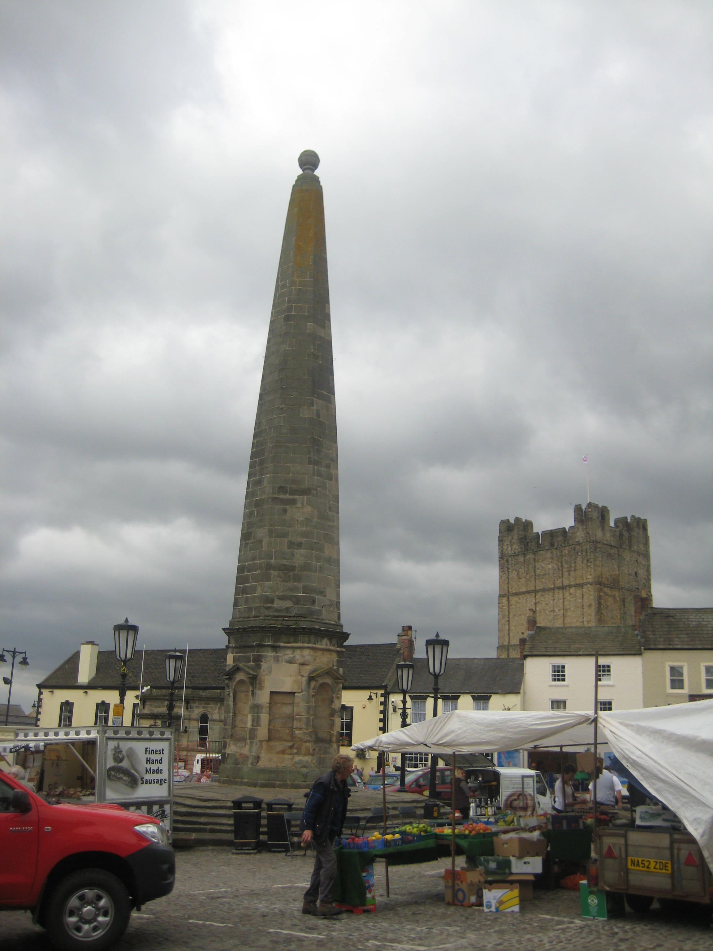
Richmond Castle can be found along the narrow streets to the south of the market place. Founded by Alan Rufus (a kinsman of William the Conqueror) in 1071, it is the oldest stone-built Norman castle in England. The castle largely comprises extensive ruins, though the great ‘keep’ is well-preserved and still a formidable building.
Back round to the market square, we emerged at the Victorian Market Hall, which continues to offer an indoor space for stallholders, in addition to the outdoor space which every Saturday is full of stalls proffering local and organic products.
Further up the street is the Town Hall, which was built in 1756 as an Assembly Room, on the site of a Medieval Guildhall. It houses an eighteenth century court-room which is open to the public.

Also in the vicinity is the obelisk, which replaced the original market cross in 1771.
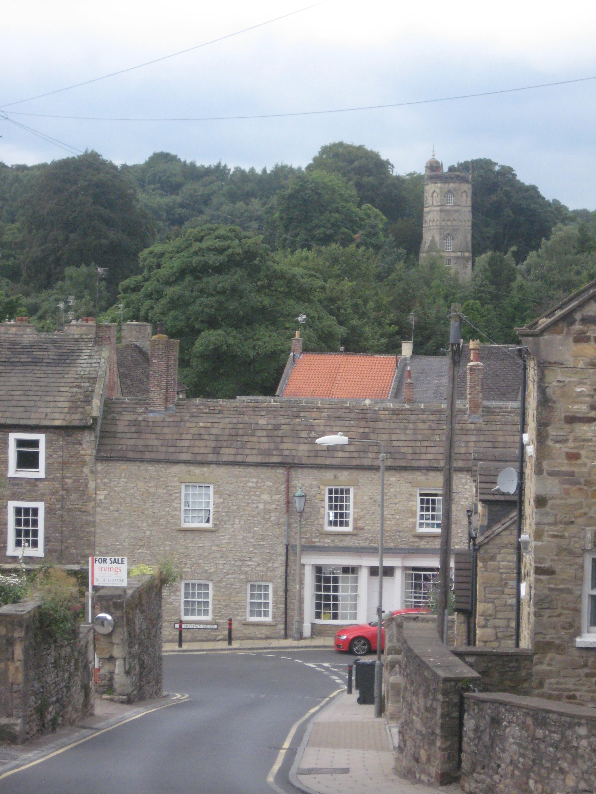
A short walk away is New Road, where Culloden Tower can be seen on the hill above the stone houses. It dates back to 1746 and was built as a private folly by John Yorke, to commemorate the defeat of the Jacobites. Today it can be hired as a holiday cottage.
Having explored the interesting miscellanea in a nearby antiques shop, we returned to the market square, skirting round the eastern side until we came to Friars Wynd, a narrow lane that originally gave access from the castle bailey to the friary. In the middle is part of the old town wall, the Postern Gate, around which remains the tramlines that were laid in 1895 to ease the movement of goods to the warehouses that were situated there.

At the end of Friars Wynd, on Victoria Road, is the recently-restored Theatre Royal. Built in 1788, it is the most complete Georgian playhouse in Britain, and continues to be used in that capacity.

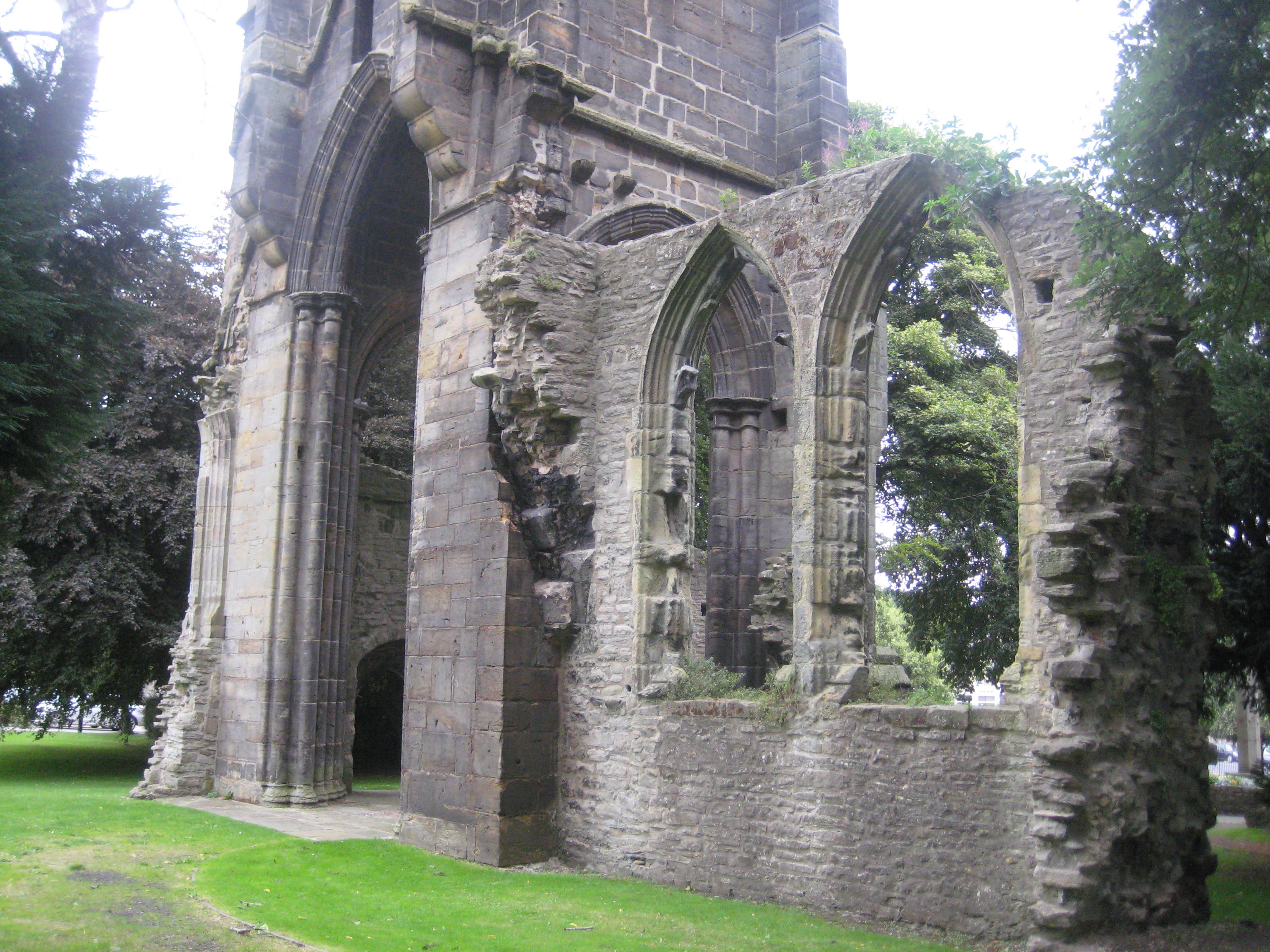
Round onto Queens Road is a park that was formerly the location of a Franciscan Friary. Founded in 1258, the main surviving part (albiet in ruins) is the fifteenth-century Grey Friars Tower. The Friary was dissolved in 1539 as part of the second phase of Henry VIII’s Dissolution of the Monasteries.


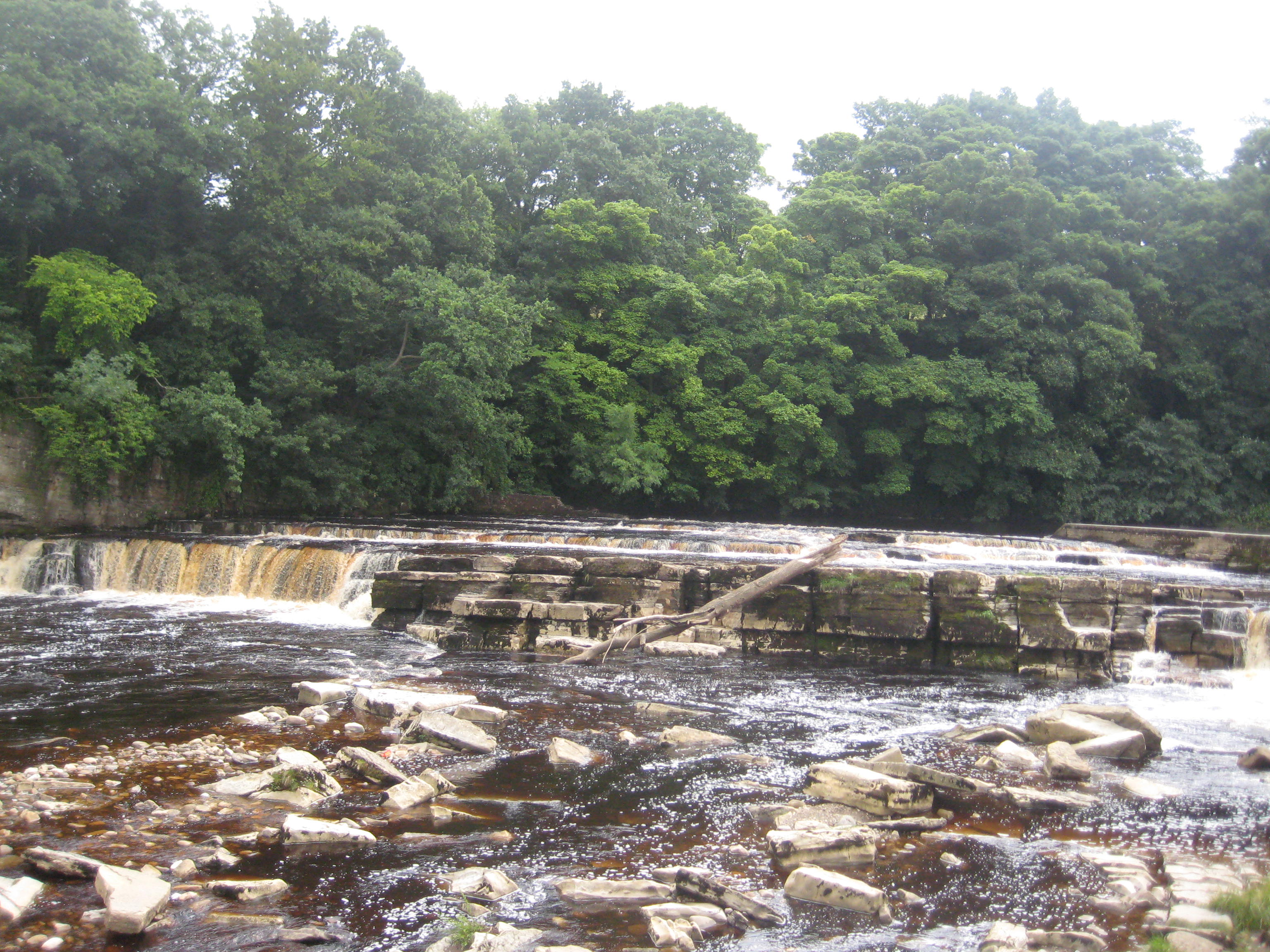
We made our way back to the market square, and down via Millgate to the River Swale. Said to be the fastest-flowing river in England (‘swale’ meaning ‘swirling’ in Old English), it rushes here over limestone slabs, creating a waterfall (called in Yorkshire a ‘force’ or ‘foss’). This was the site of a medieval corn mill and later a nineteenth-century paper mill and gas works (Richmond being one of the first towns in Europe to be lit by gaslights).
Finally, we followed the river path back to the bridge from whence our walk began.
* * * * *
The sources for this article are a map I obtained in the Tourist Information office, the plaques around the town, and the Richmond website. The photographs are the author’s own.

